Showing posts with label island. Show all posts

Tuesday, December 28, 2010

NORTH BUTON DISTRICT


-->

BY : SABRY MATASLA
Capital City : Ereke
Areal Width : -
Location : On the island of South East Sulawesi, bordered by Muna, Buton, Konawe, . and the Banda sea.
Before it was established as a new autonomous district, Nort Buton was a part of the Muna district. The new district is located to the north of Buton island, majority of the people are members of the buton ethnic group. North Buton has many potential natural resources, like plantations, farming, forestry, fishery, and oil drilling. There are a variety of tourist destinations, from natural objects and cultural sites, to the Lipu palace fortress site. There is a building inside fortress called Baruga, an auditorium building used for society meeting. One of the beautiful beaqches in this area is Labuan Belanda beach. It is said that the beach was used by a VOC ship to dock during its trip to take spices from Buton and Maluku.
LABUAN BELANDA BEACH
The beach is already the holiday destination for North Butonese people. Many activities can be done on this beach, like swimming, sailing with a local’s boad and enjoying the sunrise.

HARI ISLAND

-->
HARI ISLAND
BY : SABRY MATASALA
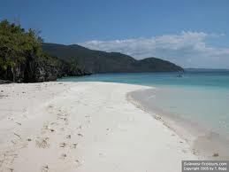
Hari island is an uninhabited island with beautiful white sand beaches. Around the island,there are marine parks that are suitable for diving and snorkeling. The sea is clear and beautiful with variety of shapes and colours of coral and a rich diversity of marine life. For those who don’t like the water sports, they can observe the seagulls and turtles laying eggs at night. For fishing, you can come to saponda luar (outside) that is only a few miles from the spot.
AGRO PUDAHOA
The area is about 100 Ha, located in Southern kendari city about 30 km from the center of the city. The area can be reached by car or motor cycle in ± 30 minutes. The area is surrounded by protected forest and it was used for a camping a area during the National Jambore in 2000 whose opening was attended by Abdul Rahman Wahid, when he was a president.
Inside the area, there are a few permanent and semi – permanent building. Recently, the buildings have been used for learning activities of Gontor Pesantren, Kendari branch. There are ± 15 Ha of rice fields, ± 5 Ha of fresh water fish ponds, and ± Ha of fields for the ceremony. Since 2005, the local government of South East Sulawesi has Planted various tropical fruits such as rambutan, durian, mangoes, and orange trees. This area is very good for agriculture. Many activities can be done, such as fising in the pons, camping, or enjoying the village atmosphere. In the fruit season, we can pick the fruit from the tree. Every year, from February to April is harvest time for rambutan and durian, so that when visiting the area during these months, you can find the fruit at an affordable price.
The slow pace of life in this area, far from the hurly-burly of the city, can be developed as spiritual tourism. Through cooperation with the peasants, the tourists, especially Moslem tourists, not only enjoy the beauty and simplicity of nature, but also can feel the peace in the agrarian life.


Sunday, December 26, 2010


RAWA AOPA WATUMOHAI NATIONAL PARK (RAWNP)

BY : SABRY MATASALA

Rawa Aopa Watumohai National Park ( RAWNP ) has many potential natural resources. According to the Government Administration, the national park is located in 4 districts : 6.238 Ha in the konawe district, located in the Lambuya and Puriala subdistrict, 12.824 Ha in the Kolaka district, located in the Tirawuta, Ladonggi Watubangga, and Tangketada subdistricts, 40.527 Ha in the south konawe districts, located in the Anggata and Tinanggea subdistricts, and 45.605 Ha in the Bombana districts, located in the Rorawatu subdistrict.

The Rawa Aopa Watumohai National Park area is merger of a few conservation areas. The Watumohai Buru Park, Rawa aopa Reservation, and Rumbia Land Buru Park, it is 105.194 Ha wide and was established as a National Park according to the decision letter of the ministry of Forestry No. 756/KPTS-ll/1990. It was been bordered with 4.158 milestones 366.673 km in length from 1985 to 1987.

The Rawa Aopa Watumohai National Park has 4 types of ecosyetem :mangrove forest, tropical forest, swamp, and savanna, thay are each in habited by a variety of wild life and rare plants that can only be found in Sulawesi. The various ecosystems have a direct affect on the number of protected wildlife inside the jungle. There are 28 kinds of mammals, of which 13 types are Sulawesi endemic, 4 types of Amphibians, of which 1 type is endemic to Sulawesi, 7 types of reptiles, 8 types of fish, 207 of birds, of which 38 types are Sulawesi endemic and 9 types are Indonesian endemic , and 323 types of plants.

As a preventation area, Rawa Aopa Watumohai National Park has tourist destinations that are similar to other tourist destinations in Indonesia. The tourist destination spread from the seashore to the lowland mountains. To reach the National Park, you can take public transportation, bus, Damri, or rented car, using route of Kendari – Ranomeeto, it is about 80 km and takes about 1 hour. The best time to visit the national park is in july or august, when local people hold their traditionalceremonies.